K2000
K2000 is a user-friendly program for inspection, editing and management of data across the entire sewer network. Starting with TV inspection and assessment of sewer conditions, K2000 also offers all functionalities to analyze and further process the acquired data. Basically, master data, geometry data and condition data can be used for sewer investigations. The modular design allows users to customize the software to their exact needs through a wide range of extensions. During inspection, K2000 can be used with a camera system from any hardware manufacturer.
Mobile and Office
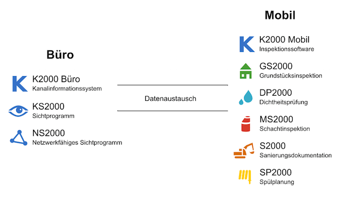
K2000 can be used both for condition assessment of sewer networks in inspection vehicles or push-rod systems (K2000 Mobile) as well as a sewer information system for office management (K2000 Office). K2000 is ideally suited for cities, municipalities, engineering firms and companies in the environmental technology sector.
Sewer Investigation with K2000
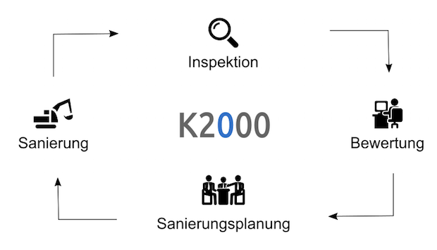
The cycle of a typical sewer investigation begins with the inspection of sewers or manholes. The condition of the object is documented using video recordings, images, measurements and reports. After inspection, the data is post-processed in the office, assessed and then a rehabilitation plan is created. The results are passed on to the client and rehabilitation measures are initiated. After rehabilitation has been carried out, the sewer is re-inspected at regular intervals.
K2000 covers all requirements of a complete sewer investigation and rehabilitation from a single source.
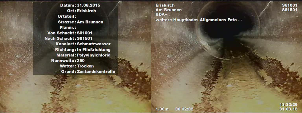
Video Recordings and Text Overlay
K2000 works fully digitally. Individual defect images, video sequences and complete inspection videos can be created and managed. Communication with a camera system is automatic including text overlay. This means all inspection-relevant data, such as video counter, distances or defects, can be displayed live in the video image.
Versatile Measurement Options
K2000 offers a wide range of measurement methods such as nominal diameter measurement, defect measurement, inclination and temperature measurement, etc. Measurements can be performed with virtually all camera systems.
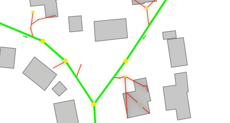
Clear Working with Site Plans
Background plans such as survey data and aerial images enable optimal orientation within the sewer network using the site plan module LP2000. The background plans and the entire sewer network are displayed graphically on screen. The cumbersome handling of partial plans becomes unnecessary, enormously speeding up work for the user. GPS can additionally be used for better navigation.
Data Exchange
For seamless exchange of master, inspection and geometry data with other systems, all common standards and interfaces are supported. The following data transfers are possible:
- License-free transfer of all data to the client via the viewer program KS2000
- Integration into a GIS system (see NS2000)
- Transfer between K2000 programs
- Import and export of master, inspection and geometry data to third-party systems
- Excel export
- PDF reports

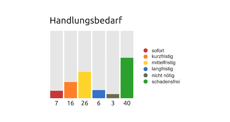
Classification and Assessment
Through defect classification and condition assessment, an automatic evaluation of the sewer network inspection results can be performed. From this, the need for action regarding rehabilitation can be easily determined, for example. Classification and assessment is carried out either in accordance with standards or user-defined.
Individually Expandable
Thanks to the modular system design, the basic equipment of the K2000 base software can be expanded with a wide range of additional modules and customized to individual requirements and needs.
Some extensions are also available as standalone compact programs that do not require a full K2000 base version:
- GS2000 Compact Property Inspection
- MS2000 Compact Manhole Inspection
- DP2000 Compact Leak Testing
Benefits at a Glance
- Standards-compliant TV inspection
- Management of the entire sewer network
- Easy operation
- Hardware-independent
- Versatile measurement methods
- Classification and assessment
- Background plans
- Support for all common data interfaces
- Reference and history management
- Management of reverse inspections