LP2000
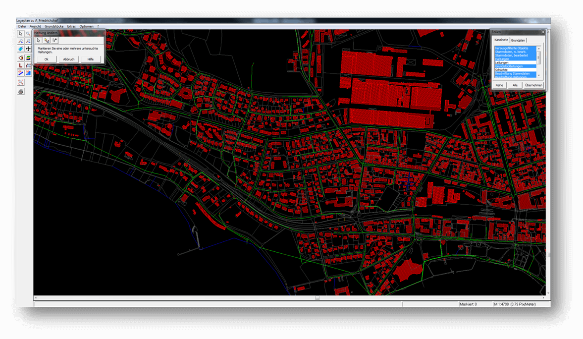
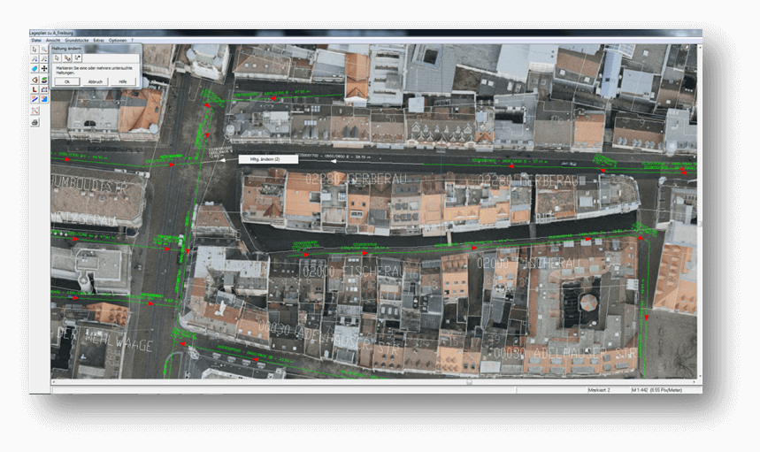
LP2000 enables comfortable working with background plans both in the vehicle and in the office. By using this extension, the entire sewer network and the associated background plan in the form of floor plans or aerial images can be displayed, and the stored master and inspection data can be accessed with a mouse click. All recorded geometry data is georeferenced.
True-to-Original Display
With the LP2000 software, the entire city map and the associated sewer network can be displayed and the stored data accessed. In addition to the city base map as a floor plan or aerial image, all data from the K2000 database is automatically displayed. Individual areas can be selected and zoomed in for a more detailed view. For documentation purposes, sections of the background plan can be output in any scale and size, e.g., via a printer. GPS can be used for orientation in vehicles.
Data Access
The site plan software extension LP2000 offers a wide range of display options for sewer data. Via the database query, for example, any data can be filtered and displayed in the site plan. Access can be made to individual elements or entire areas.
Interfaces
The background plan can work with vector data (DXF) or raster data (aerial images). Suitable imports are available in LP2000 for this purpose.
Benefits at a Glance
- Working with digital site plans and aerial images
- The sewer network is automatically drawn in
- GPS tracking of the vehicle possible
- Graphical display of the sewer network instead of tabular form
- Display of objects by search criteria (e.g., pipe diameter, defects, etc.)
- Color highlighting of inspected sections, manholes or other search criteria such as defect classes or wastewater type
- Creating sectors for managing individual areas
- Measuring objects on the PC
- Simple and fast operation
- Georeferenced working in GS2000